COMPATIBLE with iOS &
Android
AVAILABLE in App
Store & Play Store
COMPATIBLE with iOS &
Android
AVAILABLE in App
Store & Play Store
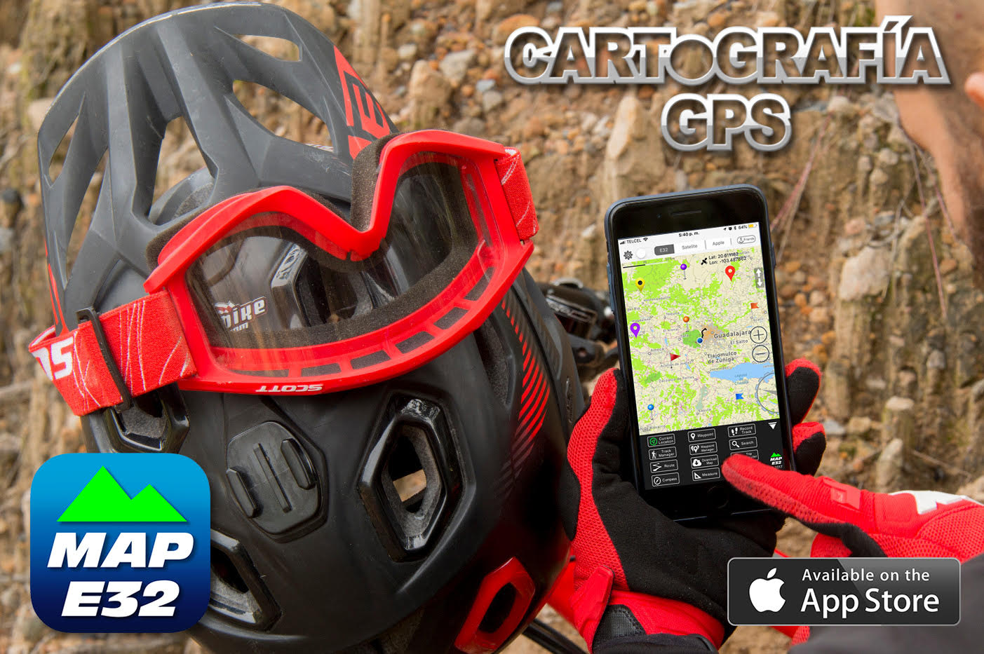
MAP E32 is a GPS app with a
topographical map of Mexico specially designed for doing routes on ATVs, enduro,
off-roading, 4x4, mountain biking, hiking, etc. In a nutshell, for any outdoor activity.
MAP E32 is perfect for the Baja 1000 race, Baja 500 and San Felipe 250 in
Baja California Peninsula, or other famous spots such as the Copper Canyon in Chihuahua or
any trip in Mexico.
Some of the features in the map are:
Highways, roads, dirt roads, trails, railroad tracks, cities, towns, airports, contour lines
every 30 meters, hills, points of interest, rivers, state borders, lakes and dams, gas
stations, etc.
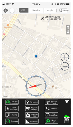
The main screen of the app, will present all the tools
you can use. These functions will help you take advantage of all of

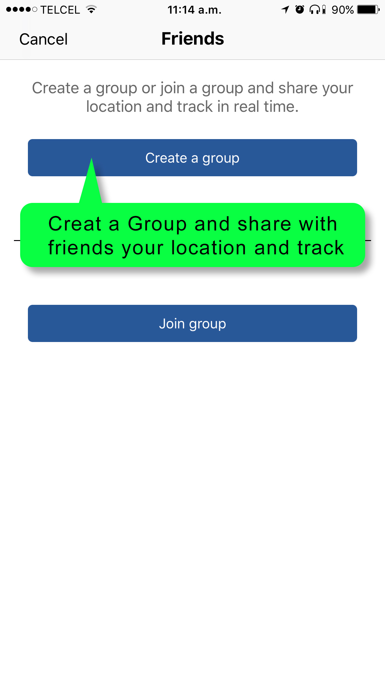
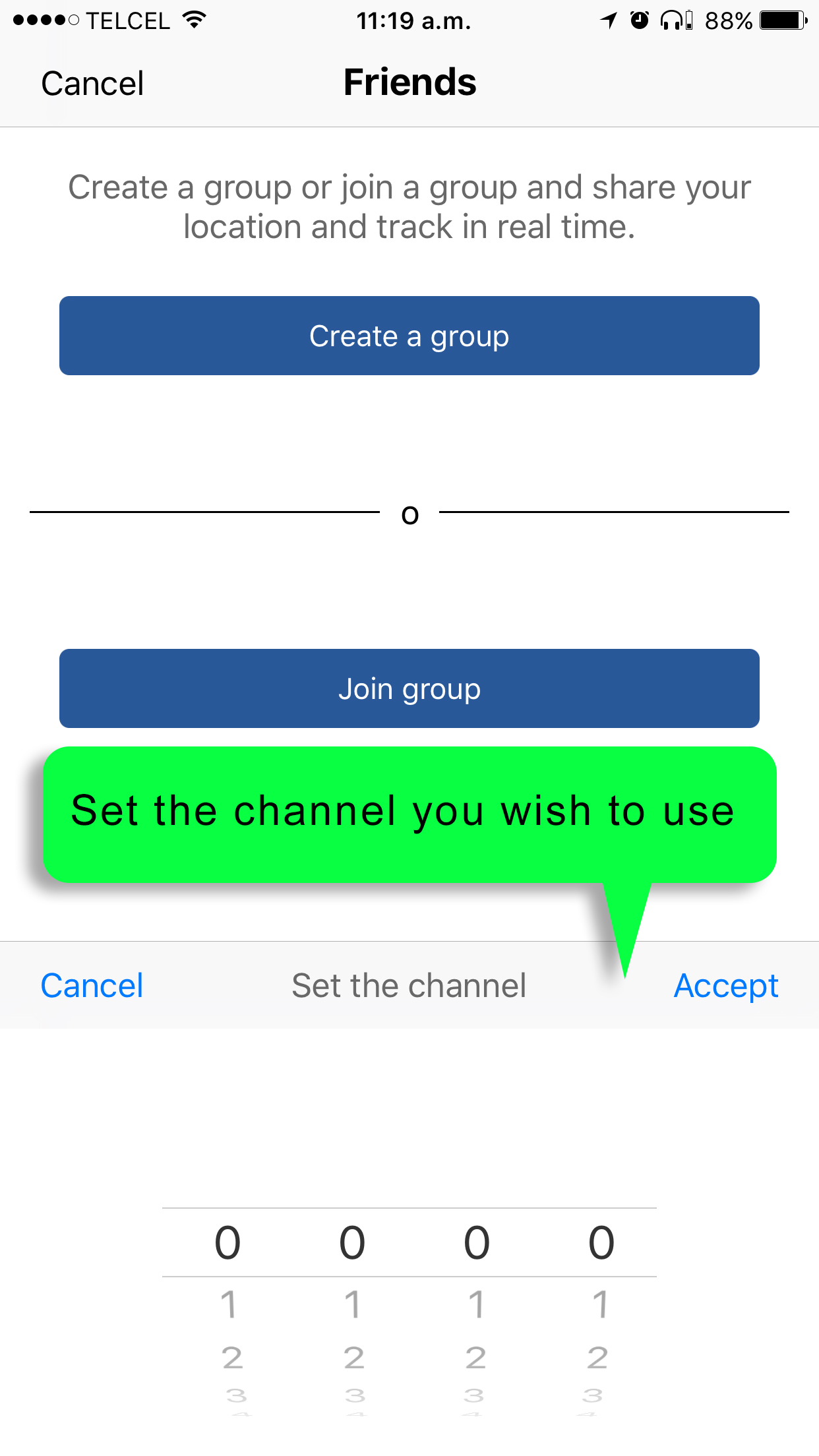
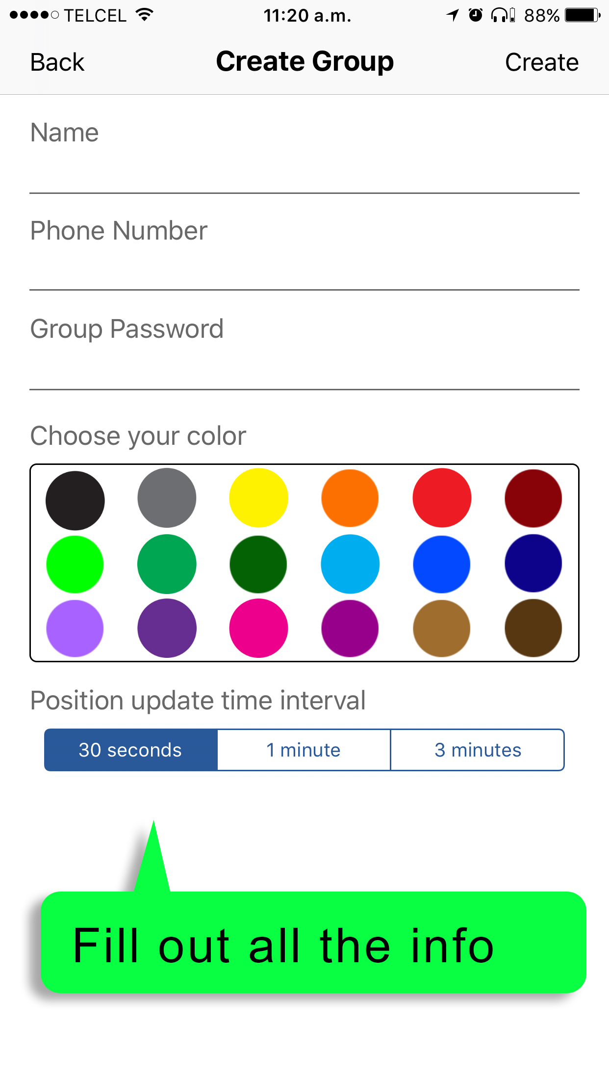
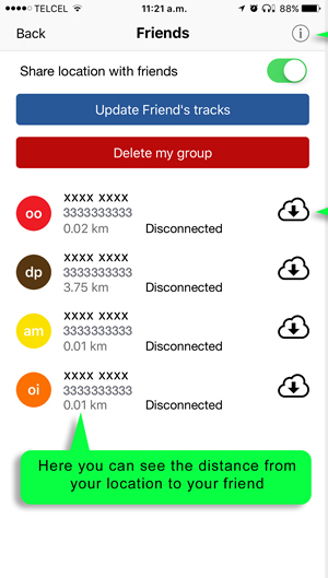
Friends module gives you the feature to create a group or join one once created. The groups are made to share your location and be able to view your friends location in the map, once you are part of a Friends group you can choose if you want to share your location or travel in private mode.
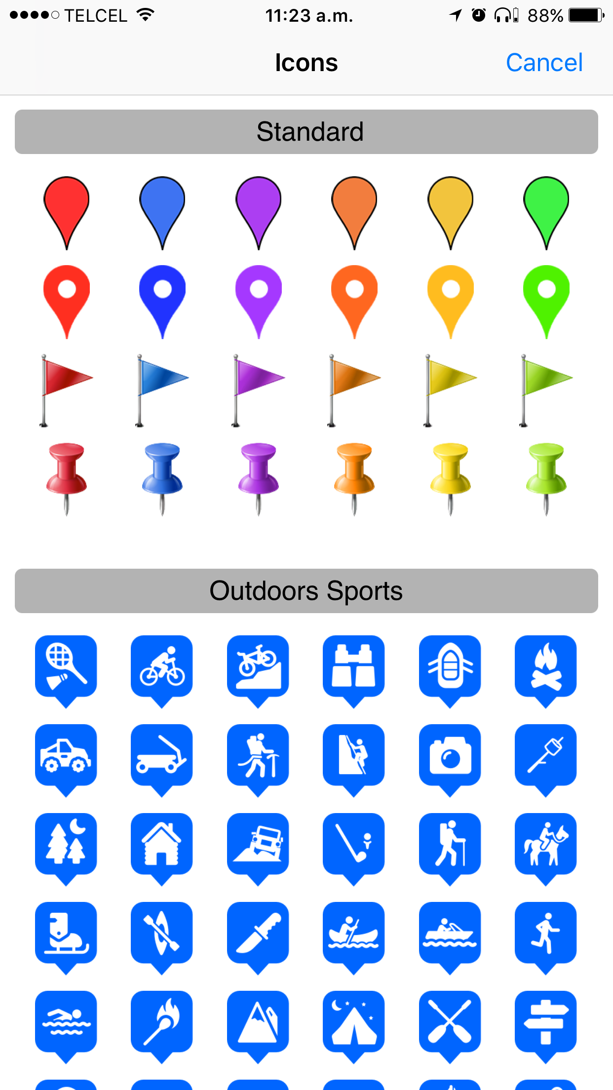
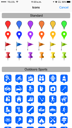
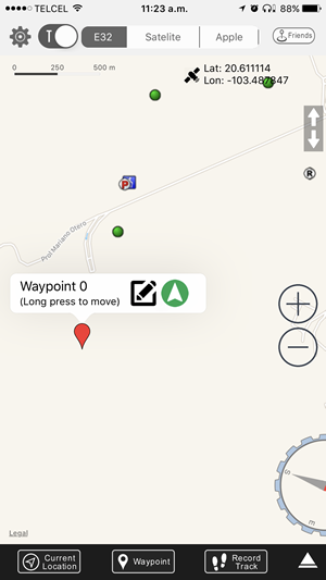
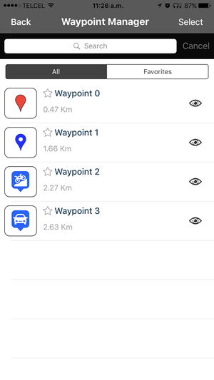
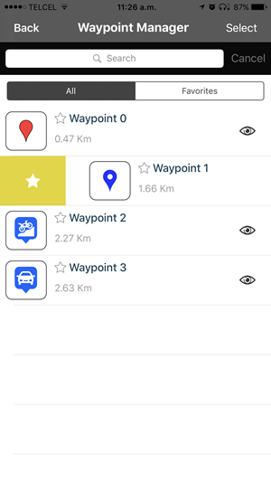
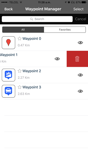
Waypoint is a functionality that helps you to mark any
location, you can customize many things to your waypoints like the name, choose an icon from the
library, write the exact latitude and longitude you want, add notes, attach a photo or choose one of
your gallery and you can share your waypoint.
Your waypoints are stored in Waypoint manager.

COMPATIBLE with iOS &
Android
AVAILABLE in App
Store & Play Store
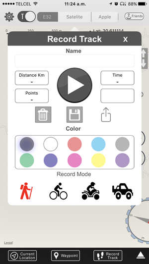
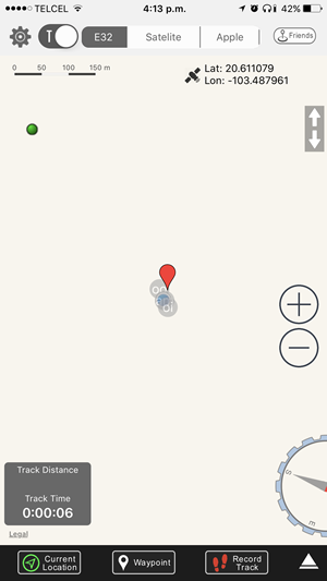
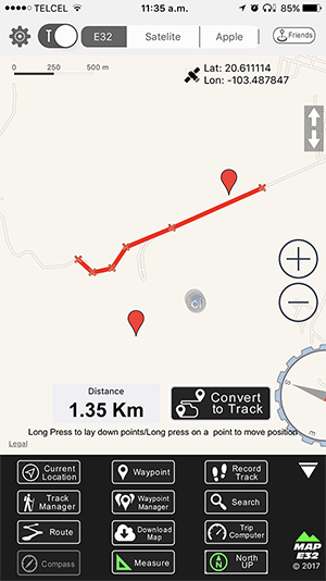
You can record your tracks with different modes,
customize the name and pick a color for the track.
You can save or delete the track, but something incredible is that you can share it with friends who
use MAP E32 as well.
When you save a record track, it will be saved to Track Manager.
The track recorder saves these features:
Distance:
Distance traveled from the beginning to the
end of the track.
Time:
Duration of the track.
Points:
Shows the number of points the track contains.
It will adapt to the travel mode chosen.
You can search for Points of Interest in MAP E32
database or you can search Points of interest or addresses in Apple map Database.
The search results are listed so you can select the one you are looking for and POI will be shown in
the map.
If you searched in the Apple Map database the place will be represented with a red flag and can be
saved in the waypoint manager.

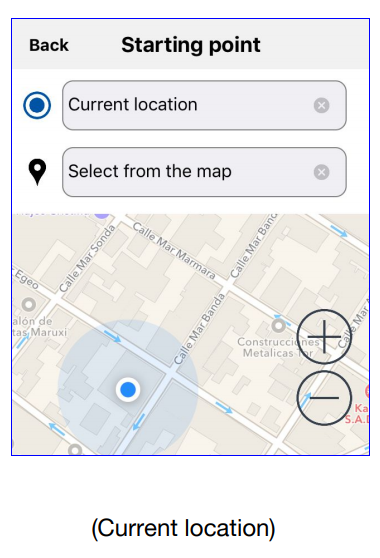
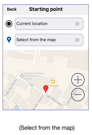
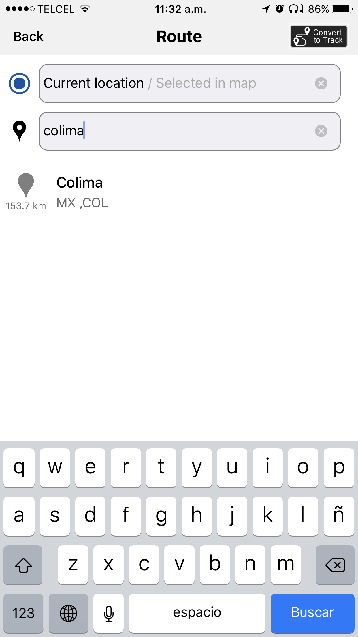
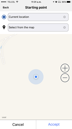
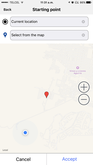
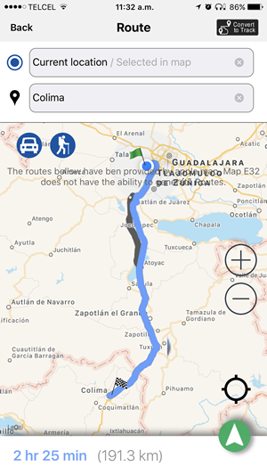
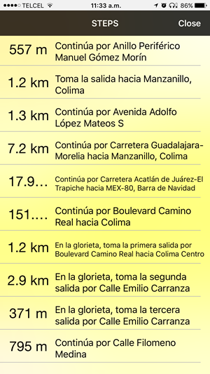
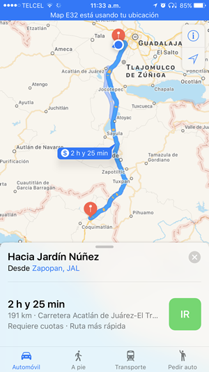
Create a route based on Apple Map database, see the
route, distance and estimated time to destination.
Your starting point can be different from your current destination! Just choose the location on the
map.
Convert this route into a track to save it in the track manager. No other app has this function!
Decide what type of route you want. If you are going by car, the app will generate the route with
transit directions. If you will be walking, MAP E32 will choose the shortest route.

COMPATIBLE with iOS &
Android
AVAILABLE in App
Store & Play Store
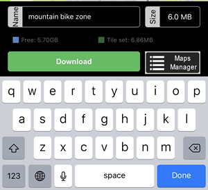
MAP E32 allows you download tiles about a region of the
map, to visualize the offline map or simply for lack of signal.
1. Choose the location and the radio.
2. Change the name of the tile for easier identification.
3. Tap download button.
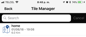
When the download finishes, your tile will be located in the section: Tile manager. In this section
you can visualize and manage the different tiles you have, preserve or delete them.

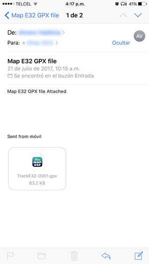
You can import GPX files that contain tracks and/or waypoints, from emails or other apps. Map E32 will import all the tracks and waypoints it contains. Track manager and Waypoint manager will save this info.
You have several options to interact with the app, in order to customize your preferences, also you can share the app with friends, rate the app and help us to improve our service.
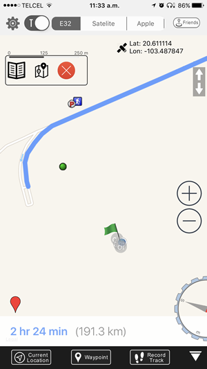
This tool allows you center and lock the map to your location point, if it is green it means it is activated and the map will move along with you, if it is not activated your location point can be moving but the map will be static.

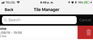
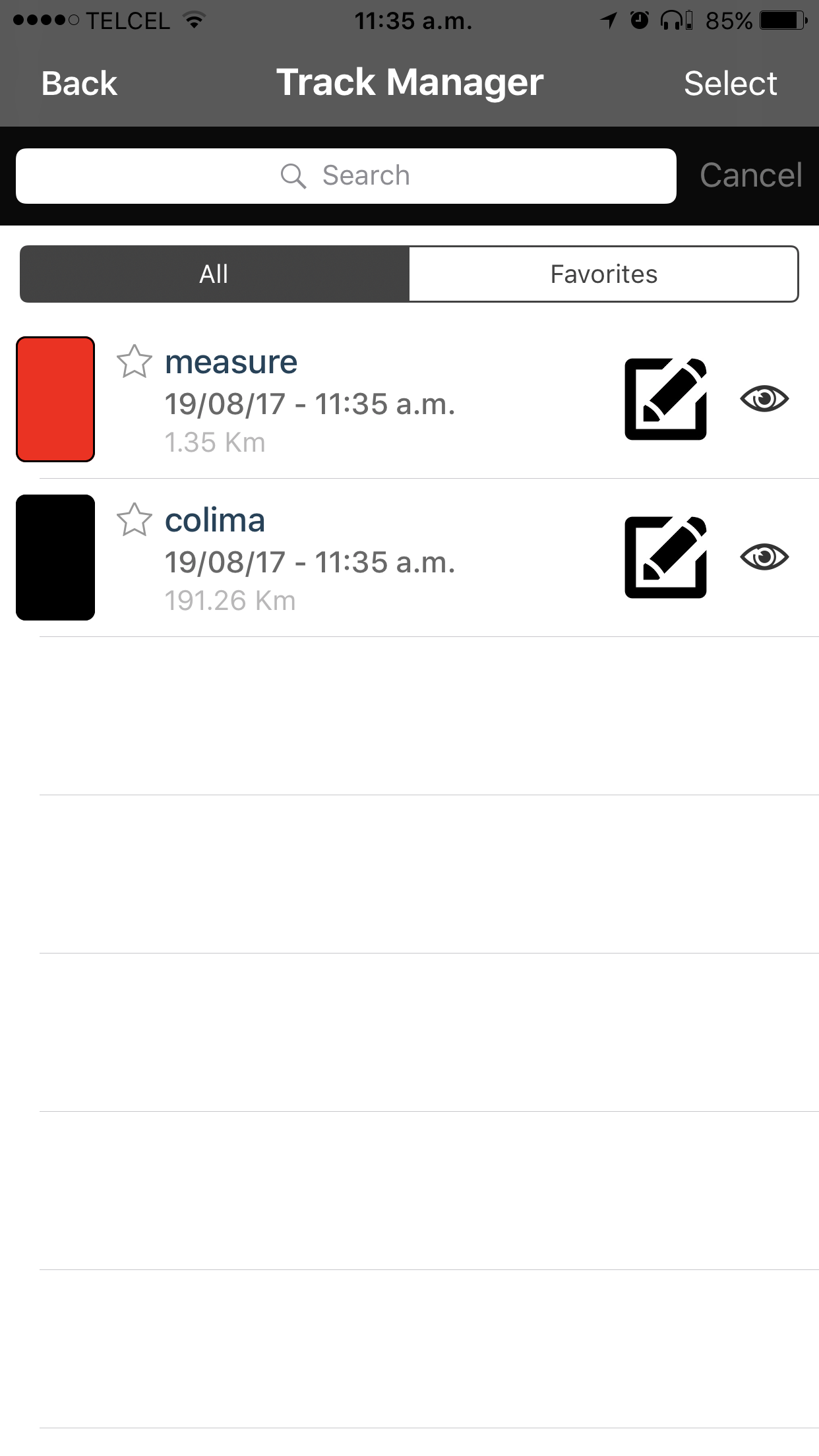
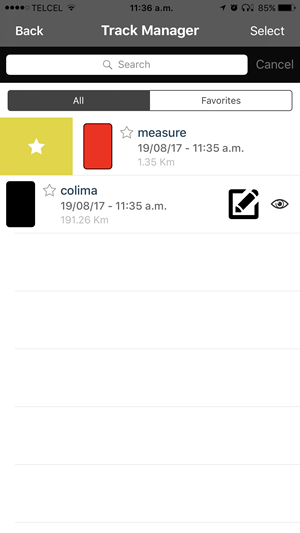
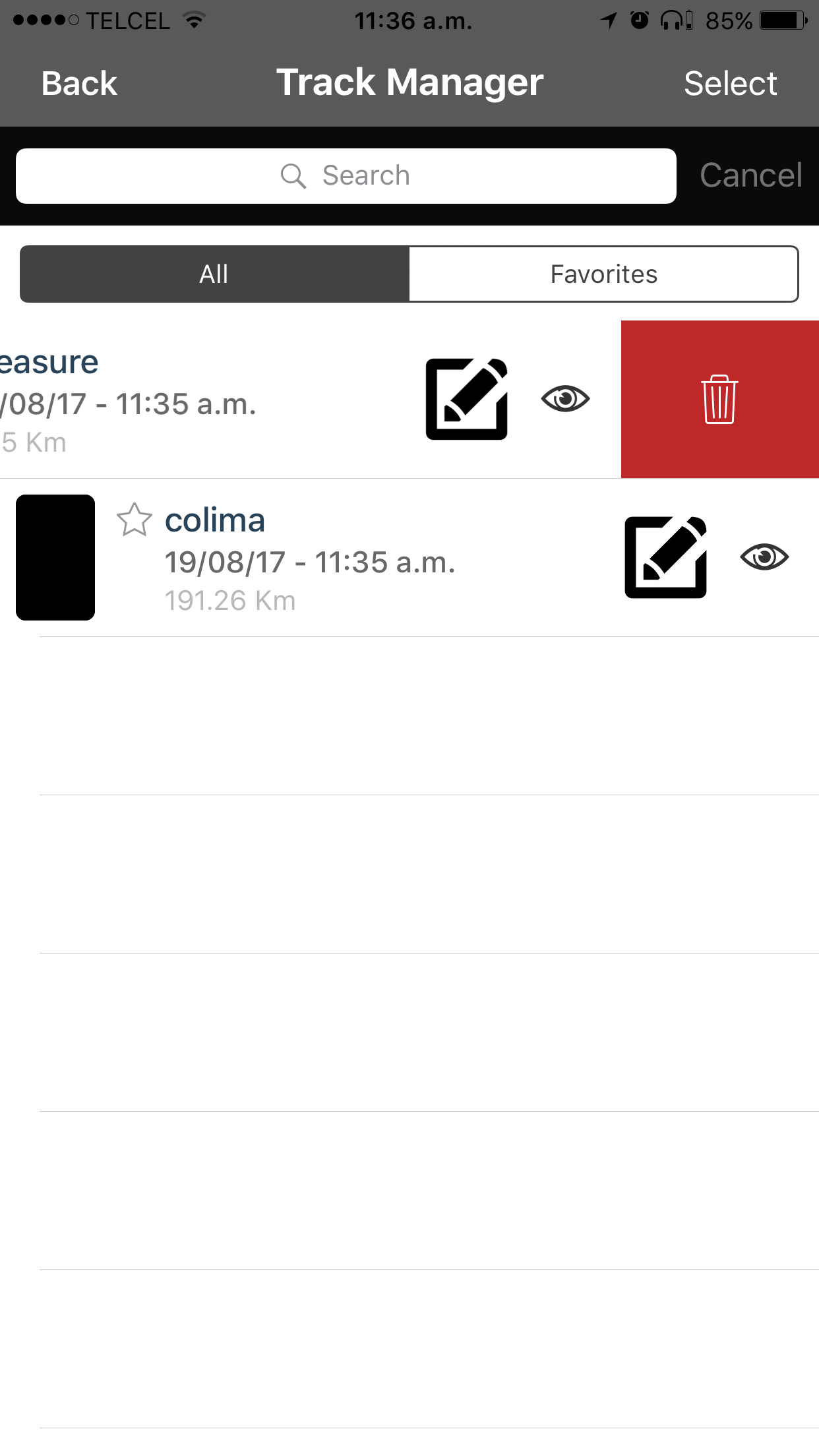
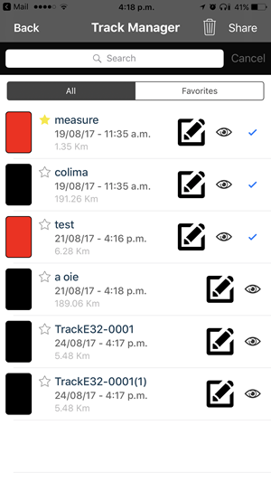
Here you can view and manage your tracks, find a
particular track, add to favorites, view all favorites and delete them.
Customize your track! A window will show your track on the map, so you can see and edit the name,
and review the date and time, distance, time, points and a series of colors.
COMPATIBLE with iOS &
Android
AVAILABLE in App
Store & Play Store
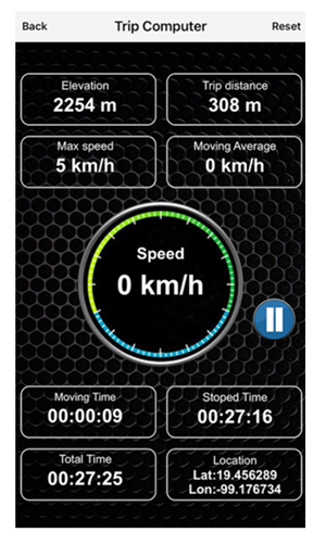
The trip computer shows your general stats since you installed the app or since your last reset. Among these stats are the elevation, the trip distance, what has been the maximum speed, moving average, the time of movement and the time you are still, your total time and shows you the latitude and longitude.

The compass is always working. You can choose whether you want it to be in the center of the screen of hide it in the right border.

This functionality allows you to measure a distance
using multi points. Only MAP E32 can do this!
If you want to create a track with this measure just take your time and make your measurement from
start to finish and use the convert to track button, the track will be saved in track manager.

This function allows you to choose the way you want to
see the map, you have 2 options North UP or User heading.
Using Noth Up, there is no rotation on the map. The User heading functionality rotates the map and
may use auto zooming, depending on your direction.

The Map E32 licence is personal and can be used in the device where the user logs in. To use your license in more than one device simultaneously, you can buy up to two additional licenses at a special discounted price 50% off each.
COMPATIBLE with iOS &
Android
AVAILABLE in App
Store & Play Store