TOPOGRAPHY
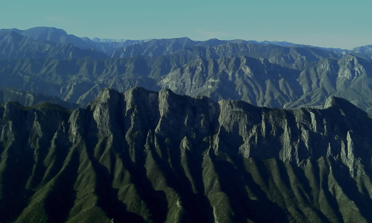
CONTOUR LINES
IN ALL MEXICO
IN ALL MEXICO
Topography is the science that studies the set of principles and procedures that have the purpose of graphically displaying the Earth’s surface, with its forms and details, both natural and aftificial. From the Greek topo-, place, and graphia, writing.
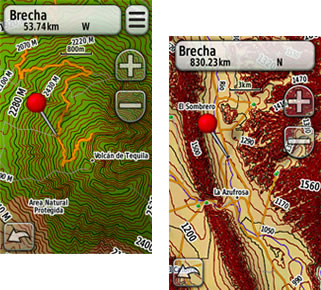
THE ONLY GPS MAP THAT HAS 300 OF THE
BEST
OFF ROAD ROUTES IN MEXICO
A contour line joins points of equal elevation
in a map, so that when used in topographical maps, they can show hills, valleys, and slopes.
The principle of contour lines: In geodesy, is each one of the elevation contours which
materializes a horizontal section of the represented relief. The equidistance, altitude
difference between two succesive curves, is constant and its value depends on the scale of
the map and the importance of the relief.


